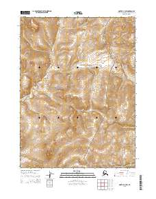
2015 Map of Noatak C-3 SW
USGS Topo · Published 2015About this map
Cape Krusenstern National Monument dominates this coastal region of Northwest Arctic, Alaska, as it appeared in 2015. This survey highlights a transitional landscape where the lowlands meet the rising topography of the Alutunitok Hills in the southeast. The interior drainage is characterized by the meandering path of Rabbit Cr, which flows through the western portion of the township. The mapping of these townships, including t25n r21w and t26n r21w, provides a precise record of the federal land boundaries and the protected natural terrain within the monument's borders. The absence of roads or permanent structures underscores the remote and preserved character of this Arctic wilderness.
Find a feature on this map
9 named features on this map. Tap any name to fly to it.
Don’t see what you’re looking for? This feature index may not catch every label — zoom into the map to look around manually.
Map Details
Editions of this 2015 Noatak C-3 SW Map
This is the sole edition of this map. No revisions or reprints were ever made.
Other maps of this area

1951 · Noatak
USGS Topo · 1:250,000

1955 · Noatak
USGS Topo · 1:250,000

1955 · Noatak B-3
USGS Topo · 1:63,360

1955 · Noatak C-4
USGS Topo · 1:63,360

1955 · Noatak C-3
USGS Topo · 1:63,360

1955 · Noatak B-4
USGS Topo · 1:63,360

1964 · Noatak
USGS Topo · 1:250,000
2014 · Noatak C-4 SE
USGS Topo · 1:25,000
2014 · Noatak C-3 NW
USGS Topo · 1:25,000
2014 · Noatak C-4 NE
USGS Topo · 1:25,000