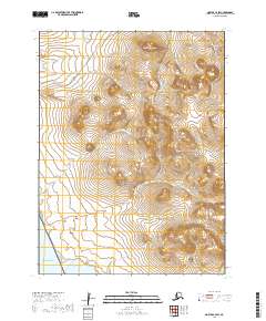
2019 Map of Noatak C-4 SW
USGS Topo · Published 2019About this map
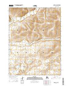
Cape Krusenstern National Monument occupies a vast portion of this coastal landscape along the Chukchi Sea, where the tundra meets the shore at Imik Lagoon. The terrain is defined by the significant elevations of Tukingak Mtn and the Mulgrave Hills, which rise above a network of waterways including Agagrak Creek and Umagatsiak Cr. A notable modern industrial corridor is visible in the northwest, where the Red Dog Mine-Haul Road cuts across the drainage of New Heart Cr. This road represents a critical piece of infrastructure for the region's mineral industry, connecting inland resources to the coast. The map provides a detailed view of the untouched wilderness within the federal monument, preserving a landscape that has supported subsistence and transit for generations.
Find a feature on this map
16 named features on this map. Tap any name to fly to it.
Don’t see what you’re looking for? This feature index may not catch every label — zoom into the map to look around manually.
Map Details
Editions of this 2019 Noatak C-4 SW Map
This is the sole edition of this map. No revisions or reprints were ever made.
Other maps of this area

1951 · Noatak
USGS Topo · 1:250,000
1952 · Noatak C-5
USGS Topo · 1:63,360

1955 · Noatak
USGS Topo · 1:250,000

1955 · Noatak C-4
USGS Topo · 1:63,360

1955 · Noatak B-4
USGS Topo · 1:63,360

1964 · Noatak
USGS Topo · 1:250,000
2014 · Noatak C-4 SE
USGS Topo · 1:25,000
2014 · Noatak C-4 NE
USGS Topo · 1:25,000
2014 · Noatak B-4 NE
USGS Topo · 1:25,000
2015 · Noatak C-4 NW
USGS Topo · 1:25,000