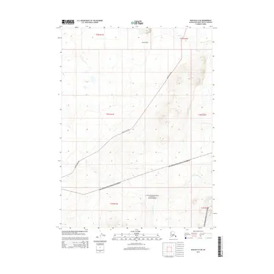
2014 Map of Noatak D-3 SW
USGS Topo · Published 2014About this map
The northern reaches of Cape Krusenstern National Monument define the southern half of this Northwest Arctic landscape. This sub-arctic wilderness is bisected by the Red Dog Mine Road, an industrial corridor that cuts diagonally across the terrain to connect remote mining operations with the coast. The topography is marked by significant elevations and water systems, including the Omikviorok River and Tutak Cr, which drain the surrounding highlands. Notable landmarks like Sivurak Bluff provide distinct navigational points in an area otherwise characterized by its isolation and the massive federal protected lands that cover much of the region. The map captures a moment in the early 21st century when mineral transport and national conservation efforts shared this expansive Alaskan environment.
Find a feature on this map
11 named features on this map. Tap any name to fly to it.
Don’t see what you’re looking for? This feature index may not catch every label — zoom into the map to look around manually.
Map Details
Editions of this 2014 Noatak D-3 SW Map
This is the sole edition of this map. No revisions or reprints were ever made.
Other maps of this area

1951 · Noatak
USGS Topo · 1:250,000

1955 · Noatak
USGS Topo · 1:250,000

1955 · Noatak D-4
USGS Topo · 1:63,360

1955 · Noatak D-3
USGS Topo · 1:63,360

1955 · Noatak C-4
USGS Topo · 1:63,360

1955 · Noatak C-3
USGS Topo · 1:63,360

1964 · Noatak
USGS Topo · 1:250,000
2014 · Noatak D-3 SE
USGS Topo · 1:25,000
2014 · Noatak D-4 SE
USGS Topo · 1:25,000
2014 · Noatak D-4 NE
USGS Topo · 1:25,000