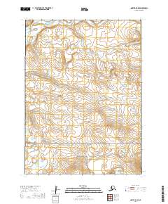
2019 Map of Noatak D-4 SE
USGS Topo · Published 2019About this map
The Cape Krusenstern National Monument occupies the southern reaches of this landscape, marking a protected interface between the tundra and the coast. This northern Arctic terrain is defined by the winding course of the Wulik River and Tutak Cr, which carve through the plains near Azigurglik Ikpik. A notable interpretive detail of the modern era is the presence of the Red Dog Mine Haul Road, a critical industrial artery that cuts across the wilderness to support mineral transport. The survey highlights prominent landforms such as Kalik Bluff, providing a clear view of the topographical transitions within the Northwest Arctic Borough just before the 2020s.
Find a feature on this map
14 named features on this map. Tap any name to fly to it.
Don’t see what you’re looking for? This feature index may not catch every label — zoom into the map to look around manually.
Map Details
Editions of this 2019 Noatak D-4 SE Map
This is the sole edition of this map. No revisions or reprints were ever made.
Other maps of this area

1951 · Noatak
USGS Topo · 1:250,000

1955 · Noatak
USGS Topo · 1:250,000

1955 · Noatak D-4
USGS Topo · 1:63,360

1955 · Noatak D-3
USGS Topo · 1:63,360

1955 · Noatak C-4
USGS Topo · 1:63,360

1955 · Noatak C-3
USGS Topo · 1:63,360

1964 · Noatak
USGS Topo · 1:250,000
2014 · Noatak D-4 SE
USGS Topo · 1:25,000
2014 · Noatak D-4 SW
USGS Topo · 1:25,000
2014 · Noatak D-4 NE
USGS Topo · 1:25,000