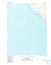
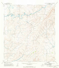
1952 Map of Noatak D-7
USGS Topo · Published 1991About this map
Arctic Ocean waters meet the coast of the Northwest Arctic Borough along this desolate stretch of the Chukchi Sea. The coastline is defined by a series of significant brackish bodies, including Singoalik Lagoon, Seppings Lagoon, and the elongated Tasikpak Lagoon. These water features are separated from the open sea by narrow gravel and sand ridges, characteristic of the dynamic coastal geomorphology found in the Alaskan Arctic. Inland, the terrain rises toward several distinct landmarks like Sakrorak Mtn and Utkusikrak Hill, which provide relief above the tundra. This 1952 photogrammetric survey, revised in 1991, captures the drainage patterns of the Singoalik River and Sakrorak Creek as they flow toward the lagoons. The map provides an essential record of the shoreline before modern environmental shifts significantly altered these fragile coastal boundaries.
Find a feature on this map
13 named features on this map. Tap any name to fly to it.
Don’t see what you’re looking for? This feature index may not catch every label — zoom into the map to look around manually.
Map Details
Editions of this 1952 Noatak D-7 Map
3 editions found
Other maps of this area

1951 · De Long Mountains
USGS Topo · 1:250,000

1951 · Noatak
USGS Topo · 1:250,000

1952 · Point Hope
USGS Topo · 1:250,000
1952 · Noatak D-7
USGS Topo · 1:63,360

1955 · Noatak
USGS Topo · 1:250,000

1955 · De Long Mountains
USGS Topo · 1:250,000

1955 · Point Hope
USGS Topo · 1:250,000

1955 · Point Hope A-1
USGS Topo · 1:63,360
1955 · Noatak D-6
USGS Topo · 1:63,360
1955 · De Long Mountains A-5
USGS Topo · 1:63,360