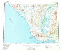
1955 Map of Noatak
USGS Topo · Published 1970About this map
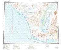
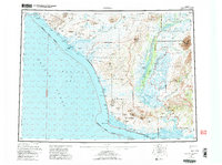
The Noatak River dominates this mid-century survey of Northwest Alaska, its braided channels weaving through the Mulgrave Hills and toward the coast of the Chukchi Sea. Coastal life centers on the village of Kivalina, situated on a narrow barrier between the Wulik River and the expansive Kivalina Lagoon. The landscape is a complex network of lagoons and inlets, including Singoalik Lagoon and Krusenstern Lagoon, which define the shoreline's shifting boundary with the sea. Interior features reveal a reliance on traditional travel and seasonal habitation, marked by the Winter Trail stretching north and various shelter cabins and cabins along the watercourses. Significant elevations like Mount Noak and the Maiyumerak Mountains provide landmarks for navigating the tundra and river basins where the Eli River and Agashashok River meet the primary drainage.
Find a feature on this map
87 named features on this map. Tap any name to fly to it.
Don’t see what you’re looking for? This feature index may not catch every label — zoom into the map to look around manually.
Map Details
Editions of this 1955 Noatak Map
7 editions found

Other maps of this area

1950 · Shishmaref
USGS Topo · 1:250,000

1951 · De Long Mountains
USGS Topo · 1:250,000

1951 · Baird Mountains
USGS Topo · 1:250,000

1951 · Selawik
USGS Topo · 1:250,000

1951 · Shishmaref
USGS Topo · 1:250,000

1951 · Noatak
USGS Topo · 1:250,000

1951 · Kotzebue
USGS Topo · 1:250,000

1951 · Misheguk Mountain
USGS Topo · 1:250,000

1951 · Kotzebue D-1
USGS Topo · 1:63,360

1951 · Kotzebue D-2
USGS Topo · 1:63,360