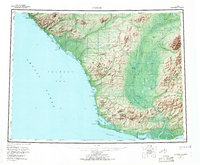
1955 Map of Noatak
USGS Topo · Published 1970About this map
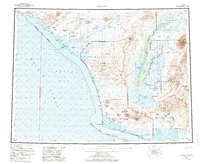
Noatak River and its expansive Noatak Slough define the eastern half of this landscape, carving through a coastal plain bounded by the Mulgrave Hills and Igichuk Hills. Along the Chukchi Sea coastline, a continuous chain of lagoons—including Kivalina Lagoon, Imikruk Lagoon, and Krusenstern Lagoon—separates the mainland from the Arctic Ocean. The village of Noatak serves as a primary inland hub, while Kivalina sits on the barrier island at Singoalik Entrance. This survey documents a traditional transportation network, featuring a prominent Winter Trail that tracks the coastline north toward Cape Seppings Lagoon. The inland terrain is marked by peaks like Iyikrok Mountain and Umarachek Peak, while the southern reaches open into Kotzebue Sound near the seasonal landmark of Sheshalik Spit.
Find a feature on this map
74 named features on this map. Tap any name to fly to it.
Don’t see what you’re looking for? This feature index may not catch every label — zoom into the map to look around manually.
Map Details
Editions of this 1955 Noatak Map
7 editions found

Other maps of this area

1950 · Shishmaref
USGS Topo · 1:250,000

1951 · De Long Mountains
USGS Topo · 1:250,000

1951 · Baird Mountains
USGS Topo · 1:250,000

1951 · Selawik
USGS Topo · 1:250,000

1951 · Shishmaref
USGS Topo · 1:250,000

1951 · Noatak
USGS Topo · 1:250,000

1951 · Kotzebue
USGS Topo · 1:250,000

1951 · Misheguk Mountain
USGS Topo · 1:250,000

1951 · Kotzebue D-1
USGS Topo · 1:63,360

1951 · Kotzebue D-2
USGS Topo · 1:63,360