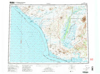
1955 Map of Noatak
USGS Topo · Published 1987About this map
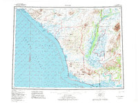
The coastal landscapes of the Northwest Arctic Borough are defined by an intricate network of lagoons and barrier islands at the edge of the Chukchi Sea. The settlement of Kivalina sits on a thin strip of land between the sea and the expansive Kivalina Lagoon, while further south, the Sheshalik Spit extends toward Kotzebue Sound. This mid-century survey captures the region's wilderness character within the Cape Krusenstern National Monument and the Noatak National Preserve, showing a landscape where seasonal movement is supported by a Winter Trail and scattered Shelter Cabins. The powerful Noatak River and Eli River wind through the interior, flanked by the Tahinichok Mountains and Kisimilot Mountains. The map provides a look at traditional subsistence geography, noting features like Kavrorak Springs and the myriad of named lagoons such as Imikruk Lagoon and Singoalik Lagoon.
Find a feature on this map
97 named features on this map. Tap any name to fly to it.
Don’t see what you’re looking for? This feature index may not catch every label — zoom into the map to look around manually.
Map Details
Editions of this 1955 Noatak Map
7 editions found

Other maps of this area

1950 · Shishmaref
USGS Topo · 1:250,000

1951 · De Long Mountains
USGS Topo · 1:250,000

1951 · Baird Mountains
USGS Topo · 1:250,000

1951 · Selawik
USGS Topo · 1:250,000

1951 · Shishmaref
USGS Topo · 1:250,000

1951 · Noatak
USGS Topo · 1:250,000

1951 · Kotzebue
USGS Topo · 1:250,000

1951 · Misheguk Mountain
USGS Topo · 1:250,000

1951 · Kotzebue D-1
USGS Topo · 1:63,360

1951 · Kotzebue D-2
USGS Topo · 1:63,360