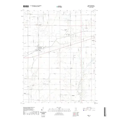
2021 Map of Noble
USGS Topo · Published 2021About this map
The village of Noble and the outskirts of Olney anchor this agricultural section of Richland County, where a grid of rural roads connects several long-standing local landmarks. The landscape is defined by the southern flow of the Fox River and its numerous tributaries, including Sugar Creek and Hog Run Creek. Genealogists will find a high concentration of small burial grounds scattered across the townships, such as North Freedom Cemetery, Shiloh Number 2 Cemetery, and Olive Branch Cemetery. Educational and infrastructure hubs are represented by the West Richland Center and the Olney-Noble Airport, while smaller crossroads communities like Pureton, Schnell, and Gallagher reflect the historical settlement patterns of the region's farming interior.
Find a feature on this map
61 named features on this map. Tap any name to fly to it.
Don’t see what you’re looking for? This feature index may not catch every label — zoom into the map to look around manually.
Map Details
Editions of this 2021 Noble Map
This is the sole edition of this map. No revisions or reprints were ever made.
Other maps of this area

1941 · Newton
USGS Topo · 1:62,500

1943 · Newton
USGS Topo · 1:62,500

1948 · Flora
USGS Topo · 1:62,500

1949 · Olney
USGS Topo · 1:62,500

1949 · Flora
USGS Topo · 1:62,500

1953 · Sailor Springs
USGS Topo · 1:62,500

1958 · Belleville
USGS Topo · 1:250,000

1962 · Belleville
USGS Topo · 1:250,000

1970 · Clay City
USGS Topo · 1:24,000

1970 · Enterprise
USGS Topo · 1:24,000