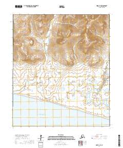
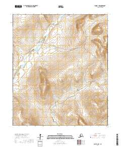
2017 Map of Nome C-2 SE
USGS Topo · Published 2017About this map
The coast of Norton Sound meets the expansive drainage basins of the Seward Peninsula in this 2017 study of the terrain northwest of Nome. The landscape is defined by its significant waterways, notably the Snake River and Penny River, which transition from upland streams into wide, meandering coastal channels. These rivers are fed by numerous tributaries such as Negsue Cr, Sunset Cr, and Honey Cr, illustrating the complex hydrology of the Alaskan tundra.
Find a feature on this map
22 named features on this map. Tap any name to fly to it.
Don’t see what you’re looking for? This feature index may not catch every label — zoom into the map to look around manually.
Map Details
Editions of this 2017 Nome C-2 SE Map
This is the sole edition of this map. No revisions or reprints were ever made.
Other maps of this area

1950 · Nome
USGS Topo · 1:250,000

1950 · Nome B-1
USGS Topo · 1:63,360

1950 · Nome C-2
USGS Topo · 1:63,360

1950 · Nome C-1
USGS Topo · 1:63,360

1951 · Nome
USGS Topo · 1:250,000

1957 · Nome
USGS Topo · 1:250,000
2017 · Nome C-1 SW
USGS Topo · 1:25,000
2017 · Nome C-2 NE
USGS Topo · 1:25,000
2017 · Nome C-1 NW
USGS Topo · 1:25,000
2017 · Nome C-2 NW
USGS Topo · 1:25,000