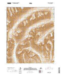
2017 Map of Nome D-2 NE
USGS Topo · Published 2017About this map
The Kigluaik Mountains dominate this portion of the Seward Peninsula, revealing a landscape defined by dramatic elevation changes and glacial legacy. The southern portion of the map is anchored by the prominent Glacial Lake, a water body that suggests the ancient ice movements that shaped these valleys. Water drainage patterns are central to the geography here, with the Cobblestone River winding through the eastern sections and the Oro Grande Creek cutting across the northern reaches. This 2017 survey provides an exacting look at the high-altitude terrain north of Nome, where features like Snow Gulch and Glacier Cr indicate the persistent cold-weather hydrology of the region. The map also delineates the transition between t6s r35w and surrounding townships, offering a precise reference for those studying the remote interior of the Nome Census Area.
Find a feature on this map
12 named features on this map. Tap any name to fly to it.
Don’t see what you’re looking for? This feature index may not catch every label — zoom into the map to look around manually.
Map Details
Editions of this 2017 Nome D-2 NE Map
This is the sole edition of this map. No revisions or reprints were ever made.
Other maps of this area

1950 · Nome D-2
USGS Topo · 1:63,360

1950 · Nome
USGS Topo · 1:250,000

1950 · Teller
USGS Topo · 1:250,000

1950 · Teller A-2
USGS Topo · 1:63,360

1950 · Nome D-1
USGS Topo · 1:63,360

1950 · Teller A-1
USGS Topo · 1:63,360

1951 · Nome
USGS Topo · 1:250,000

1951 · Teller
USGS Topo · 1:250,000

1957 · Nome
USGS Topo · 1:250,000

1957 · Teller
USGS Topo · 1:250,000