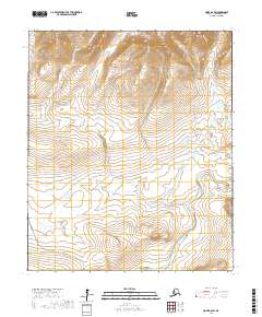
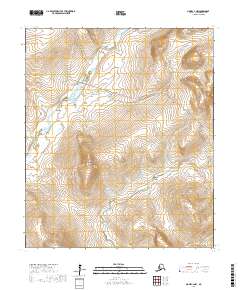
2017 Map of Nome D-2 SW
USGS Topo · Published 2017About this map
The Home-Teller Highway/Bob Blodgett Highway cuts through the southern reaches of this landscape, providing a critical overland connection across the Seward Peninsula. This corridor follows the drainage of Livingston Creek, passing through a high-latitude environment defined by a dense network of watercourses. The northern terrain is dominated by the headwaters and upper valleys of the Feather River and Johnston Creek, while the eastern portion of the sheet is shaped by the Sinuk river system. These waterways, including American Creek and Ruby Creek, illustrate the complex drainage patterns of the Nome Census Area. The map reflects the modern infrastructure and hydraulic geography of the region, where roads are few and restricted to the narrow valleys between significant mountain ridges.
Find a feature on this map
13 named features on this map. Tap any name to fly to it.
Don’t see what you’re looking for? This feature index may not catch every label — zoom into the map to look around manually.
Map Details
Editions of this 2017 Nome D-2 SW Map
This is the sole edition of this map. No revisions or reprints were ever made.
Other maps of this area

1950 · Nome D-2
USGS Topo · 1:63,360

1950 · Nome
USGS Topo · 1:250,000
1950 · Nome C-3
USGS Topo · 1:63,360

1950 · Nome D-3
USGS Topo · 1:63,360

1950 · Nome C-2
USGS Topo · 1:63,360

1951 · Nome
USGS Topo · 1:250,000

1957 · Nome
USGS Topo · 1:250,000
1975 · Nome C-3
USGS Topo · 1:63,360
2017 · Nome C-2 NE
USGS Topo · 1:25,000
2017 · Nome C-2 NW
USGS Topo · 1:25,000