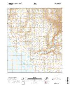
2017 Map of Nome D-3 NW
USGS Topo · Published 2017About this map
The Tisuk River winds through this coastal Seward Peninsula landscape toward its outlet at Norton Sound. This 2017 survey reveals an intricate drainage system defined by family-named and prospect-style waterways that reflect the region's enduring relationship with placer mining and coastal hydrology. Notable tributaries include Upper Quartz Cr and Dome Cr, while the western reaches are marked by the presence of Last Chance Cr and Just Chance Cr.
Find a feature on this map
18 named features on this map. Tap any name to fly to it.
Don’t see what you’re looking for? This feature index may not catch every label — zoom into the map to look around manually.
Map Details
Editions of this 2017 Nome D-3 NW Map
This is the sole edition of this map. No revisions or reprints were ever made.
Other maps of this area

1950 · Nome D-4
USGS Topo · 1:63,360

1950 · Nome
USGS Topo · 1:250,000

1950 · Teller
USGS Topo · 1:250,000

1950 · Nome D-3
USGS Topo · 1:63,360

1950 · Teller A-3
USGS Topo · 1:63,360

1950 · Teller A-4
USGS Topo · 1:63,360

1951 · Nome
USGS Topo · 1:250,000

1951 · Teller
USGS Topo · 1:250,000

1957 · Nome
USGS Topo · 1:250,000

1957 · Teller
USGS Topo · 1:250,000