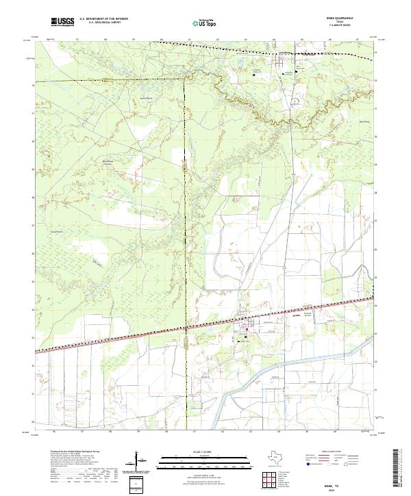
2022 Map of Nome
USGS Topo · Published 2022About this map
Pine Island Bayou meanders across the northern border of this Gulf Coast prairie landscape, marking the historical divide between Hardin, Liberty, and Jefferson counties. The settlement of Nome serves as a central hub in the south, where the local economy is tied to the land through operations like the Farm Air Service and the extensive water management of the Lower Neches Valley Authority Canal. The area is defined by its distinct expanses of open ground, including Swift Prairie and Whitehead Prairie, which are dissected by a complex network of drainage features such as Horsepen Gully and Uncle Charlie Slough.
Find a feature on this map
53 named features on this map. Tap any name to fly to it.
Don’t see what you’re looking for? This feature index may not catch every label — zoom into the map to look around manually.
Map Details
Editions of this 2022 Nome Map
This is the sole edition of this map. No revisions or reprints were ever made.
Other maps of this area

1943 · Whites Bayou
USGS Topo · 1:24,000

1943 · Liberty
USGS Topo · 1:125,000

1945 · Nolte
USGS Topo · 1:31,680

1950 · Houston
USGS Topo · 1:250,000

1954 · Beaumont
USGS Topo · 1:250,000

1955 · Daisetta
USGS Topo · 1:62,500

1955 · Sour Lake
USGS Topo · 1:62,500

1956 · Houston
USGS Topo · 1:250,000

1957 · Beaumont
USGS Topo · 1:250,000
1961 · Whites Bayou
USGS Topo · 1:24,000