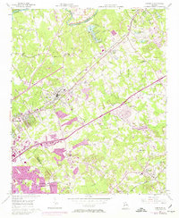
1956 Map of Norcross
USGS Topo · Published 1974About this map
The Chattahoochee River forms the natural northwestern boundary of this Gwinnett County region, where the Southern Railway corridor anchors established towns like Norcross and Duluth. By the mid-1970s, the landscape reflects the rapid suburban expansion of the Atlanta area, visible in the purple-tinted urban extensions and the path of the Northeast Expressway. Despite this growth, older community landmarks remain, such as Beaver Ruin Ch and the Camp Creek Cem.
Find a feature on this map
47 named features on this map. Tap any name to fly to it.
Don’t see what you’re looking for? This feature index may not catch every label — zoom into the map to look around manually.
Map Details
Editions of this 1956 Norcross Map
4 editions found
Other maps of this area

1888 · Atlanta
USGS Topo · 1:125,000

1890 · Suwanee
USGS Topo · 1:125,000

1890 · Atlanta
USGS Topo · 1:125,000

1892 · Atlanta
USGS Topo · 1:125,000

1894 · Suwanee
USGS Topo · 1:125,000

1895 · Atlanta
USGS Topo · 1:125,000

1953 · Atlanta
USGS Topo · 1:250,000

1954 · Chamblee
USGS Topo · 1:24,000

1954 · Decatur
USGS Topo · 1:24,000

1955 · Rome
USGS Topo · 1:250,000