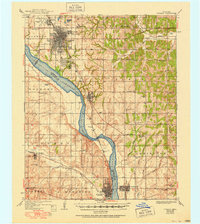
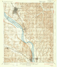
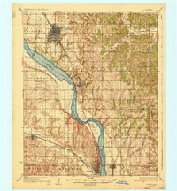
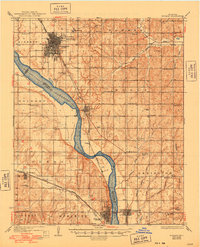
1936 Map of Norman
USGS Topo · Published 1951About this map
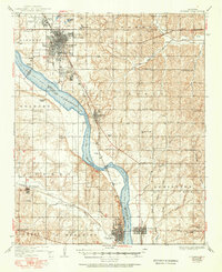
The University of Oklahoma and its surrounding campus developments anchor the northern portion of this Central Oklahoma landscape, recorded during the mid-1930s with updates into the early 1950s. The region is defined by the wide, shifting course of the Canadian River, which separates Cleveland and McClain Counties. Along its banks, the Santa Fe railroad corridor serves as the primary industrial spine, connecting the major hubs of Norman, Noble, and Purcell. This era of the landscape shows a high density of rural social infrastructure, with dozens of family and community landmarks like Woody Chapel, Independence School, and Gripping Springs Cemetery scattered across the uplands. Aviation history is also prominent on this sheet, featuring Westheiner Field and an Emergency Landing Field south of the river, highlighting the region's growing importance in mid-century transportation networks.
Find a feature on this map
66 named features on this map. Tap any name to fly to it.
Don’t see what you’re looking for? This feature index may not catch every label — zoom into the map to look around manually.
Map Details
Editions of this 1936 Norman Map
5 editions found
Other maps of this area

1892 · Moore
USGS Topo · 1:62,500

1893 · Norman
USGS Topo · 1:62,500

1893 · Oklahoma City
USGS Topo · 1:62,500

1898 · Purcell
USGS Topo · 1:125,000

1898 · Pauls Valley
USGS Topo · 1:125,000

1902 · Pauls Valley
USGS Topo · 1:125,000

1902 · Rush Springs
USGS Topo · 1:125,000

1904 · Chickasha
USGS Topo · 1:125,000
1910 · McComb
USGS Topo · 1:62,500

1925 · Norman NO 2
USGS Topo · 1:24,000