
1936 Map of Norman
USGS Topo · Published 1936About this map
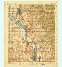
Norman dominates the northern landscape of this mid-1930s survey, showing the early layout of the University of Oklahoma and the nearby State Hospital. The Canadian River cuts a wide, braided path southeastward, serving as the primary boundary between Cleveland Co and Mc Clain Co. This waterway was a significant barrier and conduit for the region, noted here by the Norman Bridge and the No 77 Toll Bridge further south near Purcell.
Find a feature on this map
67 named features on this map. Tap any name to fly to it.
Don’t see what you’re looking for? This feature index may not catch every label — zoom into the map to look around manually.
Map Details
Editions of this 1936 Norman Map
5 editions found
Other maps of this area

1892 · Moore
USGS Topo · 1:62,500

1893 · Norman
USGS Topo · 1:62,500

1893 · Oklahoma City
USGS Topo · 1:62,500

1898 · Purcell
USGS Topo · 1:125,000

1898 · Pauls Valley
USGS Topo · 1:125,000

1902 · Pauls Valley
USGS Topo · 1:125,000

1902 · Rush Springs
USGS Topo · 1:125,000

1904 · Chickasha
USGS Topo · 1:125,000

1910 · McComb
USGS Topo · 1:62,500

1925 · Norman NO 2
USGS Topo · 1:24,000