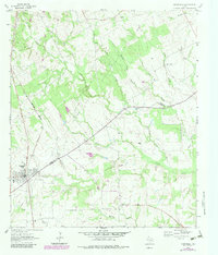
1964 Map of Normangee
USGS Topo · Published 1983About this map
Normangee serves as the focal point of this rural Texas landscape, situated along the Burlington Northern rail line where the borders of Leon and Madison counties meet. The settlement patterns of the mid-1960s reflect a deep-rooted agricultural and spiritual community, with scattered churches such as Galilee Ch and Shiloh Ch anchoring the countryside. Local family history is preserved in several burial grounds, including the Rodgers Prairie Cem and Sand Prairie Cem, which sit near the older settlement sites of Rodgers Prairie and Carter.
Find a feature on this map
28 named features on this map. Tap any name to fly to it.
Don’t see what you’re looking for? This feature index may not catch every label — zoom into the map to look around manually.
Map Details
Editions of this 1964 Normangee Map
2 editions found
Other maps of this area

1925 · Iola No 2
USGS Topo · 1:48,000

1931 · Iola
USGS Topo · 1:62,500

1953 · Palestine
USGS Topo · 1:250,000

1954 · Waco
USGS Topo · 1:250,000

1954 · Beaumont
USGS Topo · 1:250,000

1954 · Austin
USGS Topo · 1:250,000

1955 · Waco
USGS Topo · 1:250,000

1957 · Beaumont
USGS Topo · 1:250,000

1957 · Palestine
USGS Topo · 1:250,000

1963 · Madisonville
USGS Topo · 1:24,000