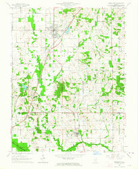
1963 Map of Norris City
USGS Topo · Published 1964About this map
Norris City serves as the focal point of this Southern Illinois landscape, where the New York Central Railroad and the Baltimore and Ohio Railroad intersect to form a vital transportation hub. The surrounding terrain of Indian Creek and Heralds Prairie is dotted with evidence of early rural life and community, including numerous country churches such as Union Ch and Ebenezer Ch. To the south, the village of Omaha sits near the winding course of the North Fork Saline River.
Find a feature on this map
40 named features on this map. Tap any name to fly to it.
Don’t see what you’re looking for? This feature index may not catch every label — zoom into the map to look around manually.
Map Details
Editions of this 1963 Norris City Map
2 editions found
Other maps of this area

1905 · Eldorado
USGS Topo · 1:62,500

1905 · New Haven
USGS Topo · 1:62,500

1906 · New Haven
USGS Topo · 1:62,500

1906 · Eldorado
USGS Topo · 1:62,500

1940 · Carmi
USGS Topo · 1:62,500

1941 · Enfield
USGS Topo · 1:62,500

1943 · Carmi
USGS Topo · 1:62,500

1944 · Enfield
USGS Topo · 1:62,500

1949 · Paducah
USGS Topo · 1:250,000

1949 · New Haven
USGS Topo · 1:62,500