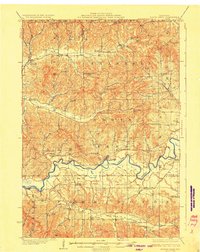
1929 Map of North Bend
USGS Topo · Published 1929About this map
North Bend sits at a strategic crossing of the Black River in this 1929 edition, serving as a hub for the surrounding agricultural valleys of Jackson and La Crosse Counties. The landscape is defined by its deep coulees and ridges, where narrow valley floors like German Coulee and Washington Coulee host a dense network of rural infrastructure. The mapping reveals a high concentration of country schools serving these tight-knit farming communities, including the uniquely named Little Red Sch and Lone Star Sch.
Find a feature on this map
75 named features on this map. Tap any name to fly to it.
Don’t see what you’re looking for? This feature index may not catch every label — zoom into the map to look around manually.
Map Details
Editions of this 1929 North Bend Map
2 editions found

Other maps of this area

1909 · Sparta
USGS Topo · 1:62,500

1924 · Black River Falls
USGS Topo · 1:62,500

1926 · Black River Falls
USGS Topo · 1:62,500

1926 · North Bend
USGS Topo · 1:62,500

1926 · Whitehall
USGS Topo · 1:62,500

1927 · Blair
USGS Topo · 1:62,500

1927 · La Crosse
USGS Topo · 1:62,500

1928 · Melrose
USGS Topo · 1:48,000

1929 · Whitehall
USGS Topo · 1:62,500

1929 · Galesville
USGS Topo · 1:62,500