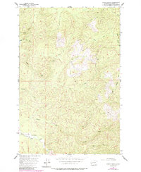
1955 Map of North Nemah
USGS Topo · Published 1985About this map
North Nemah sits along the North Nemah River in a landscape defined by an intricate network of coastal river forks and timbered drainages. This mid-century survey illustrates the region's reliance on its waterways and the Nemah Road corridor, with the State Salmon Hatchery serving as a significant landmark near the river's bend. The terrain is deeply carved by the Canon River and the various branches of the Palix River, including its North Fork, Middle Fork, and South Fork Willapa River.
Find a feature on this map
17 named features on this map. Tap any name to fly to it.
Don’t see what you’re looking for? This feature index may not catch every label — zoom into the map to look around manually.
Map Details
Editions of this 1955 North Nemah Map
4 editions found
Other maps of this area

1938 · Fort Columbia
USGS Topo · 1:62,500

1938 · South Bend
USGS Topo · 1:62,500

1940 · Brookfield
USGS Topo · 1:62,500

1940 · South Bend
USGS Topo · 1:62,500

1943 · Fort Columbia
USGS Topo · 1:62,500

1949 · Upper Naselle River
USGS Topo · 1:24,000

1949 · Oman Ranch
USGS Topo · 1:24,000

1949 · Long Island
USGS Topo · 1:24,000

1953 · Hoquiam
USGS Topo · 1:250,000

1955 · Grays River
USGS Topo · 1:62,500