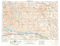
1954 Map of North Platte
USGS Topo · Published 1973About this map
Sand Hills dominate the northern landscape, where an intricate network of rural schools like Yucca Hill School and McPherson School served isolated ranching communities. In the southern half, the North Platte River and South Platte River converge at North Platte, creating a corridor defined by significant water management projects. This mid-century view documents an extensive system of canals and reservoirs, including the Sutherland Canal and the massive Lake C W McConaughy, which transformed the region's hydrology and agriculture. The arrival of the Union Pacific railroad and the path of U S Highway 30 anchored towns like Ogallala and Sutherland to the interstate economy. Further north, the Dismal River and Middle Loup River cut through the dunes, while the Nebraska National Forest stands as a notable interruption to the natural grasslands.
Find a feature on this map
62 named features on this map. Tap any name to fly to it.
Don’t see what you’re looking for? This feature index may not catch every label — zoom into the map to look around manually.
Map Details
Editions of this 1954 North Platte Map
3 editions found

Other maps of this area

1896 · Lexington
USGS Topo · 1:125,000

1897 · Ogallala
USGS Topo · 1:125,000

1898 · Paxton
USGS Topo · 1:125,000

1899 · Lexington
USGS Topo · 1:125,000

1899 · North Platte
USGS Topo · 1:125,000

1900 · Chappell
USGS Topo · 1:125,000

1900 · Ogallala
USGS Topo · 1:125,000

1901 · Paxton
USGS Topo · 1:125,000

1902 · Gothenburg
USGS Topo · 1:125,000

1902 · North Platte
USGS Topo · 1:125,000