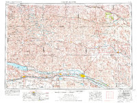
1954 Map of North Platte
USGS Topo · Published 1976About this map
North Platte and the surrounding Sand Hills define this mid-1970s look at Nebraska's central high plains. The landscape is characterized by the confluence of the North Platte River and South Platte River, a vital water corridor that supported the development of the Union Pacific railroad and U S Highway 30. Large-scale water management is evident through the presence of Lake C W McConaughy, held by Kingsley Dam, and the extensive North Platte Canal system that feeds the Sutherland Reservoir.
Find a feature on this map
76 named features on this map. Tap any name to fly to it.
Don’t see what you’re looking for? This feature index may not catch every label — zoom into the map to look around manually.
Map Details
Editions of this 1954 North Platte Map
3 editions found

Other maps of this area

1896 · Lexington
USGS Topo · 1:125,000

1897 · Ogallala
USGS Topo · 1:125,000

1898 · Paxton
USGS Topo · 1:125,000

1899 · Lexington
USGS Topo · 1:125,000

1899 · North Platte
USGS Topo · 1:125,000

1900 · Chappell
USGS Topo · 1:125,000

1900 · Ogallala
USGS Topo · 1:125,000

1901 · Paxton
USGS Topo · 1:125,000

1902 · Gothenburg
USGS Topo · 1:125,000

1902 · North Platte
USGS Topo · 1:125,000