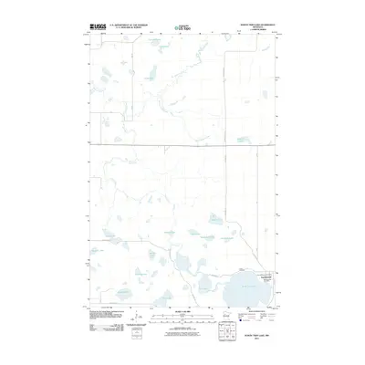
2011 Map of North Twin Lake
USGS Topo · Published 2011About this map
Naytahwaush serves as the primary community in this lake-heavy portion of Mahnomen County, centered around the Naytahwaush Post Office and the southern shores of North Twin Lake. The geography is defined by a dense network of glacial basins and waterways, with the Wild Rice River winding across the northern landscape while Twin Creek meanders through the central and southern sections. Cultural and family history is anchored at the Indian Cemetery and Samuel Memorial Cemetery, both situated near the town site. The map details a transition from the structured residential roads of the settlement to more rural routes like Res Hwy 12 and County Hwy 122. Scattered throughout the wetlands are numerous named water bodies including Rice Lake, Peabody Lake, and Barney Lakes, reflecting the complex hydrology and environmental character of northwestern Minnesota.
Find a feature on this map
32 named features on this map. Tap any name to fly to it.
Don’t see what you’re looking for? This feature index may not catch every label — zoom into the map to look around manually.
Map Details
Editions of this 2011 North Twin Lake Map
This is the sole edition of this map. No revisions or reprints were ever made.
Other maps of this area

1954 · Bemidji
USGS Topo · 1:250,000

1957 · Bemidji
USGS Topo · 1:250,000

1958 · Bemidji
USGS Topo · 1:250,000

1969 · North Twin Lake
USGS Topo · 1:24,000

1969 · Ebro
USGS Topo · 1:24,000

1969 · Roy Lake
USGS Topo · 1:24,000

1969 · Tulaby Lake
USGS Topo · 1:24,000
1969 · Ogema NE
USGS Topo · 1:24,000

1969 · Snider Lake
USGS Topo · 1:24,000
1969 · Ebro NW
USGS Topo · 1:24,000