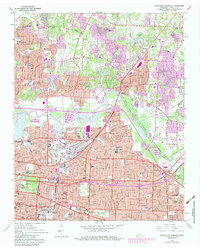
1965 Map of Northeast Memphis
USGS Topo · Published 1983About this map
Memphis sprawls across the southwestern portion of this map, showing the city's significant expansion into eastern Shelby County during the mid-20th century. The landscape is a mix of dense residential grids and institutional land use, anchored by the sprawling Overton Park which houses the Memphis Academy of Arts and the Brooks Memorial Art Gallery. The industrial and logistics legacy of the city is evident at the Leiwood Yards and the complex rail networks of the Seaboard System and Icg railroads. To the north, the communities of Raleigh and Frayser appear as established suburbs, while the Wolf River and Fletcher Creek provide a natural corridor through the developing terrain. Educational and religious centers like Memphis Baptist College and St Michaels Sch serve as community hubs alongside the solemn grounds of the Memphis National Cemetery.
Find a feature on this map
106 named features on this map. Tap any name to fly to it.
Don’t see what you’re looking for? This feature index may not catch every label — zoom into the map to look around manually.
Map Details
Editions of this 1965 Northeast Memphis Map
4 editions found
Other maps of this area

1916 · Memphis
USGS Topo · 1:62,500

1925 · Memphis
USGS Topo · 1:48,000

1927 · Memphis
USGS Topo · 1:62,500

1931 · Jericho
USGS Topo · 1:62,500

1939 · Jericho
USGS Topo · 1:62,500

1939 · Memphis
USGS Topo · 1:62,500

1942 · Millington
USGS Topo · 1:62,500

1952 · Jericho
USGS Topo · 1:62,500

1953 · Memphis
USGS Topo · 1:250,000

1955 · Memphis
USGS Topo · 1:62,500