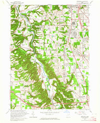
1963 Map of Northfield
USGS Topo · Published 1964About this map
The Cuyahoga River carves a deep valley through the center of this map, defining the boundary between suburban expansion and protected natural landscapes. To the west, the Brecksville Reservation and Furnace Run Reservation preserve the dramatic topography of the river's bluffs, while the east side shows a mid-century landscape in transition. Early 1960s development is evident in the clusters of Northfield Center and Macedonia, where new schools like Nordonia High Sch and commercial hubs like the Shopping Center near Ledge Road have appeared.
Find a feature on this map
72 named features on this map. Tap any name to fly to it.
Don’t see what you’re looking for? This feature index may not catch every label — zoom into the map to look around manually.
Map Details
Editions of this 1963 Northfield Map
4 editions found
Other maps of this area

1903 · Cleveland
USGS Topo · 1:62,500

1903 · Akron
USGS Topo · 1:62,500

1905 · Akron
USGS Topo · 1:62,500

1906 · Kent
USGS Topo · 1:62,500

1906 · Chagrin Falls
USGS Topo · 1:62,500

1908 · Chagrin Falls
USGS Topo · 1:62,500

1950 · Cleveland
USGS Topo · 1:250,000

1953 · Chagrin Falls
USGS Topo · 1:24,000

1953 · Shaker Heights
USGS Topo · 1:24,000

1953 · Broadview Heights
USGS Topo · 1:24,000