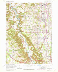
1963 Map of Northfield
USGS Topo · Published 1968About this map
The Cuyahoga River meanders through a deep valley, creating a sharp divide between the upland suburbanizing townships and the protected wooded expanses of the Brecksville Reservation and Bedford Reservation. This era shows Northern Summit County in a state of rapid post-war growth, where new housing developments in Northfield and Macedonia press against established institutions like the Hawthornden State Hospital and Sagamore Hills Hospital.
Find a feature on this map
58 named features on this map. Tap any name to fly to it.
Don’t see what you’re looking for? This feature index may not catch every label — zoom into the map to look around manually.
Map Details
Editions of this 1963 Northfield Map
4 editions found
Other maps of this area

1903 · Cleveland
USGS Topo · 1:62,500

1903 · Akron
USGS Topo · 1:62,500

1905 · Akron
USGS Topo · 1:62,500

1906 · Kent
USGS Topo · 1:62,500

1906 · Chagrin Falls
USGS Topo · 1:62,500

1908 · Chagrin Falls
USGS Topo · 1:62,500

1950 · Cleveland
USGS Topo · 1:250,000

1953 · Chagrin Falls
USGS Topo · 1:24,000

1953 · Shaker Heights
USGS Topo · 1:24,000

1953 · Broadview Heights
USGS Topo · 1:24,000