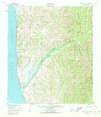
1950 Map of Norton Bay A-4
USGS Topo · Published 1972About this map
The remote shoreline of Norton Sound meets the dramatic topography of the Norton Bay region in this 1950 topographical survey. The settlement at Egavik serves as a focal point where the wide, braided mouth of Egavik Creek enters the sea. This landscape is defined by the logistical challenges of the mid-century Arctic, evidenced by the presence of a Winter Trail and an Approx Winter Trail that navigate the varied elevations and watercourses. Smaller drainages like Junction Creek and the coastal waters of Beeson Slough illustrate the complex drainage patterns common to this subarctic environment. The presence of a lone Cabin south of the main settlement highlights the isolation and subsistence-oriented land use of the era, while the map's hydrographic data includes soundings compiled as far back as 1900, showing the long-term importance of marine navigation to this coastal outpost.
Find a feature on this map
8 named features on this map. Tap any name to fly to it.
Don’t see what you’re looking for? This feature index may not catch every label — zoom into the map to look around manually.
Map Details
Editions of this 1950 Norton Bay A-4 Map
3 editions found
Other maps of this area

1948 · Norton Bay
USGS Topo · 1:250,000

1950 · Norton Bay B-5
USGS Topo · 1:63,360

1950 · Norton Bay B-4
USGS Topo · 1:63,360

1950 · Norton Bay B-3
USGS Topo · 1:63,360

1950 · Unalakleet D-3
USGS Topo · 1:63,360

1950 · Norton Bay A-4
USGS Topo · 1:63,360

1950 · Norton Bay A-3
USGS Topo · 1:63,360

1950 · Unalakleet D-4
USGS Topo · 1:63,360

1951 · Unalakleet
USGS Topo · 1:250,000

1951 · Norton Bay
USGS Topo · 1:250,000