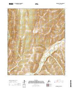
2017 Map of Norton Bay C-3 NW
USGS Topo · Published 2017About this map
The Nulato Hills dominate this portion of the Nome Census Area, forming the high ground above the interior drainage systems of western Alaska. The Shaktoolik River meanders through the central and southern reaches of the quadrangle, carving a distinct valley through the upland terrain. This 2017 survey by the U.S. Geological Survey captures a landscape defined by its hydrology and relief, where smaller tributaries like Christmas Cr feed into the larger river systems. The map reflects a remote wilderness partitioned by the Public Land Survey System, illustrating the townships and ranges that define the administrative geography of this unpopulated stretch of the Alaskan interior.
Find a feature on this map
9 named features on this map. Tap any name to fly to it.
Don’t see what you’re looking for? This feature index may not catch every label — zoom into the map to look around manually.
Map Details
Editions of this 2017 Norton Bay C-3 NW Map
This is the sole edition of this map. No revisions or reprints were ever made.
Other maps of this area

1948 · Norton Bay
USGS Topo · 1:250,000

1950 · Norton Bay D-4
USGS Topo · 1:63,360

1950 · Norton Bay C-3
USGS Topo · 1:63,360

1950 · Norton Bay D-3
USGS Topo · 1:63,360

1950 · Norton Bay C-4
USGS Topo · 1:63,360

1951 · Norton Bay
USGS Topo · 1:250,000

1955 · Norton Bay
USGS Topo · 1:250,000
2014 · Norton Bay D-4 SE
USGS Topo · 1:25,000
2014 · Norton Bay C-4 NE
USGS Topo · 1:25,000
2017 · Norton Bay C-3 NE
USGS Topo · 1:25,000