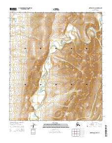
2014 Map of Norton Bay C-4 NE
USGS Topo · Published 2014About this map
The Ungalik River creates a meandering path through this subarctic interior north of Norton Bay, defining the central drainage of this unpopulated landscape. The terrain is characterized by the broad valley of the river system, with Inglutalik River Road providing one of the few terrestrial transit corridors through the western portion of the region. This 2014 survey captures the area’s hydrography in detail, showing the network of unnamed tributaries that feed into the main river channel. In the southeastern corner, the small drainage of Christmas Cr marks the edge of the adjacent township boundaries, illustrating the intersection of natural watercourses and the Public Land Survey System in this part of Alaska.
Find a feature on this map
9 named features on this map. Tap any name to fly to it.
Don’t see what you’re looking for? This feature index may not catch every label — zoom into the map to look around manually.
Map Details
Editions of this 2014 Norton Bay C-4 NE Map
This is the sole edition of this map. No revisions or reprints were ever made.
Other maps of this area

1948 · Norton Bay
USGS Topo · 1:250,000

1950 · Norton Bay D-4
USGS Topo · 1:63,360

1950 · Norton Bay C-3
USGS Topo · 1:63,360

1950 · Norton Bay D-3
USGS Topo · 1:63,360

1950 · Norton Bay C-4
USGS Topo · 1:63,360

1951 · Norton Bay
USGS Topo · 1:250,000

1955 · Norton Bay
USGS Topo · 1:250,000
2014 · Norton Bay D-4 SE
USGS Topo · 1:25,000
2014 · Norton Bay C-4 NW
USGS Topo · 1:25,000
2014 · Norton Bay D-4 SW
USGS Topo · 1:25,000