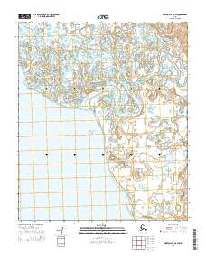
2014 Map of Norton Bay D-4 SW
USGS Topo · Published 2014About this map
Akulik River and the Inglutalik River dominate this coastal landscape as they wind through low-lying marshlands toward the eastern edge of Norton Bay. This 2014 survey captures a shifting interface between freshwater drainages and the Bering Sea, characterized by complex oxbows and numerous unnamed ponds. The only major evidence of infrastructure in this area is the Koyuk Inglutalik River Road, which traverses the northern section of the map, providing a vital land link across the tundra. The map is a detailed record of the hydrography near the Seward Peninsula, showing the natural progression of river channels as they approach the coast in a region largely defined by its lack of permanent settlements.
Find a feature on this map
10 named features on this map. Tap any name to fly to it.
Don’t see what you’re looking for? This feature index may not catch every label — zoom into the map to look around manually.
Map Details
Editions of this 2014 Norton Bay D-4 SW Map
This is the sole edition of this map. No revisions or reprints were ever made.
Other maps of this area

1948 · Norton Bay
USGS Topo · 1:250,000

1950 · Norton Bay D-5
USGS Topo · 1:63,360

1950 · Norton Bay D-4
USGS Topo · 1:63,360

1950 · Norton Bay C-5
USGS Topo · 1:63,360

1950 · Norton Bay C-4
USGS Topo · 1:63,360

1951 · Norton Bay
USGS Topo · 1:250,000

1955 · Norton Bay
USGS Topo · 1:250,000
2014 · Norton Bay D-5 SE
USGS Topo · 1:25,000
2014 · Norton Bay D-4 SE
USGS Topo · 1:25,000
2014 · Norton Bay C-4 NW
USGS Topo · 1:25,000