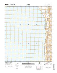
2014 Map of Norton Bay C-4 NW
USGS Topo · Published 2014About this map
Bering Sea dominates the western expanse of this coastal study, where the waters of Norton Bay meet the low-lying shoreline of western Alaska. The map illustrates a transitional marine environment defined by subtle topographic shifts and the vast reach of the tidal waters. Public Land Survey System grids, such as t9s r11w, establish the administrative framework over this remote stretch of the Seward Peninsula region. The mapping highlights the intersection of the immense northern sea and the indented coastline, providing a clear record of the shoreline's configuration in the early twenty-first century. This data is essential for understanding the physical geography and hydrography of the region's easternmost reaches before more contemporary changes.
Find a feature on this map
8 named features on this map. Tap any name to fly to it.
Don’t see what you’re looking for? This feature index may not catch every label — zoom into the map to look around manually.
Map Details
Editions of this 2014 Norton Bay C-4 NW Map
This is the sole edition of this map. No revisions or reprints were ever made.
Other maps of this area

1948 · Norton Bay
USGS Topo · 1:250,000

1950 · Norton Bay D-5
USGS Topo · 1:63,360

1950 · Norton Bay D-4
USGS Topo · 1:63,360

1950 · Norton Bay C-5
USGS Topo · 1:63,360

1950 · Norton Bay C-4
USGS Topo · 1:63,360

1951 · Norton Bay
USGS Topo · 1:250,000

1955 · Norton Bay
USGS Topo · 1:250,000
2014 · Norton Bay D-5 SE
USGS Topo · 1:25,000
2014 · Norton Bay D-4 SE
USGS Topo · 1:25,000
2014 · Norton Bay D-4 SW
USGS Topo · 1:25,000