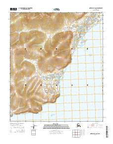
2014 Map of Norton Bay D-5 SW
USGS Topo · Published 2014About this map
The Bering Sea coastline defines this portion of the Norton Bay region, where tidal flats and intricate coastal drainage systems meet the open water. This 2014 survey captures the meandering path of the Kuiuktulik River as it winds across the low-lying terrain before reaching the sea. The landscape is characterized by a high density of small ponds and wetlands typical of the Alaskan coastal tundra, punctuated by the northern reach of the Miniatulik River. A singular point of land-based transport, Six Mile Road, traces a path along the higher ground near the river system, providing a rare interior link through the township boundaries of t7s r13w and t7s r14w. This map offers a technical perspective on a remote shoreline where the interaction between freshwater river discharge and the sea is the primary geographical focus.
Find a feature on this map
9 named features on this map. Tap any name to fly to it.
Don’t see what you’re looking for? This feature index may not catch every label — zoom into the map to look around manually.
Map Details
Editions of this 2014 Norton Bay D-5 SW Map
This is the sole edition of this map. No revisions or reprints were ever made.
Other maps of this area

1948 · Norton Bay
USGS Topo · 1:250,000

1950 · Norton Bay D-6
USGS Topo · 1:63,360

1950 · Norton Bay D-5
USGS Topo · 1:63,360

1950 · Norton Bay C-6
USGS Topo · 1:63,360

1950 · Norton Bay C-5
USGS Topo · 1:63,360

1951 · Norton Bay
USGS Topo · 1:250,000

1955 · Norton Bay
USGS Topo · 1:250,000
2014 · Norton Bay D-5 SE
USGS Topo · 1:25,000
2014 · Norton Bay D-6 NE
USGS Topo · 1:25,000
2014 · Norton Bay D-5 NW
USGS Topo · 1:25,000