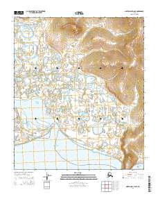
2014 Map of Norton Bay D-6 SE
USGS Topo · Published 2014About this map
The Kwik River meanders across a vast deltaic landscape as it nears its mouth at the edge of Norton Bay. This 2014 topographic study by the U.S. Geological Survey illustrates the transition from the low-lying wetlands and countless small tundra ponds of the coastal plain to the rising terrain of Bald Head. The intricate braiding of the river and the presence of Horseshoe Cr highlight the dynamic nature of this shoreline environment where fresh water meets the Bering Sea. To the east, the topography shifts abruptly into the contoured hills of t7s r14w, providing a clear view of the geographic relief that defines the eastern boundary of the bay.
Find a feature on this map
9 named features on this map. Tap any name to fly to it.
Don’t see what you’re looking for? This feature index may not catch every label — zoom into the map to look around manually.
Map Details
Editions of this 2014 Norton Bay D-6 SE Map
This is the sole edition of this map. No revisions or reprints were ever made.
Other maps of this area

1948 · Norton Bay
USGS Topo · 1:250,000

1950 · Norton Bay D-6
USGS Topo · 1:63,360

1950 · Norton Bay D-5
USGS Topo · 1:63,360

1950 · Norton Bay C-6
USGS Topo · 1:63,360

1950 · Norton Bay C-5
USGS Topo · 1:63,360

1951 · Norton Bay
USGS Topo · 1:250,000

1955 · Norton Bay
USGS Topo · 1:250,000
2014 · Norton Bay D-6 NE
USGS Topo · 1:25,000
2014 · Norton Bay D-5 SW
USGS Topo · 1:25,000
2014 · Norton Bay D-5 NW
USGS Topo · 1:25,000