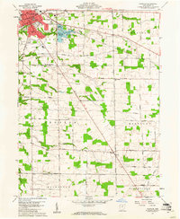
1960 Map of Norwalk
USGS Topo · Published 1961About this map
Norwalk serves as the focal point of this 1960 survey, situated within the historic Connecticut Western Reserve of north-central Ohio. The city's northern core is characterized by its organized street grid, including Central Ave and Benedict Ave, and the critical transit corridor of the New York Central & St Louis RR. To the east, a series of water management features including the Lower Reservoir, Memorial Reservoir, and Upper Reservoir follow the course of Norwalk Creek, illustrating the town's mid-century infrastructure.
Find a feature on this map
49 named features on this map. Tap any name to fly to it.
Don’t see what you’re looking for? This feature index may not catch every label — zoom into the map to look around manually.
Map Details
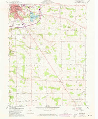
Editions of this 1960 Norwalk Map
2 editions found
Other maps of this area

1903 · Vermilion
USGS Topo · 1:62,500

1904 · Sandusky
USGS Topo · 1:62,500

1908 · New London
USGS Topo · 1:62,500

1915 · Norwalk
USGS Topo · 1:62,500

1944 · Norwalk
USGS Topo · 1:62,500

1956 · Toledo
USGS Topo · 1:250,000

1959 · Kimball
USGS Topo · 1:24,000

1959 · Milan
USGS Topo · 1:24,000

1959 · Berlin Heights
USGS Topo · 1:24,000

1960 · New London
USGS Topo · 1:24,000