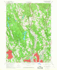
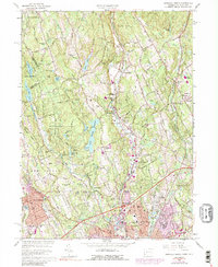
1960 Map of Norwalk North
USGS Topo · Published 1967About this map
Wilton and Weston serve as the central anchors for this Fairfield County landscape, where the Saugatuck River and Silvermine River systems dictate the local topography. By the early 1960s, the area reflects a transition toward suburban residential development while maintaining significant open space and water infrastructure, evidenced by the South Norwalk Reservoir and the Filtration Plant. Small neighborhood clusters like Cannondale, Silvermine, and Winnipauk are clearly defined, often centered around historical landmarks such as Cobbs Mill Pond or local institutions like the Strong Comstock Sch and Winnipauk Sch.
Find a feature on this map
96 named features on this map. Tap any name to fly to it.
Don’t see what you’re looking for? This feature index may not catch every label — zoom into the map to look around manually.
Map Details
Editions of this 1960 Norwalk North Map
5 editions found
Other maps of this area

1892 · Stamford
USGS Topo · 1:62,500

1892 · Danbury
USGS Topo · 1:62,500

1892 · Norwalk
USGS Topo · 1:62,500

1892 · Carmel
USGS Topo · 1:62,500

1893 · Carmel
USGS Topo · 1:62,500

1893 · Stamford
USGS Topo · 1:62,500

1893 · Norwalk
USGS Topo · 1:62,500

1894 · Carmel
USGS Topo · 1:62,500

1899 · Stamford
USGS Topo · 1:62,500

1915 · Danbury
USGS Topo · 1:62,500