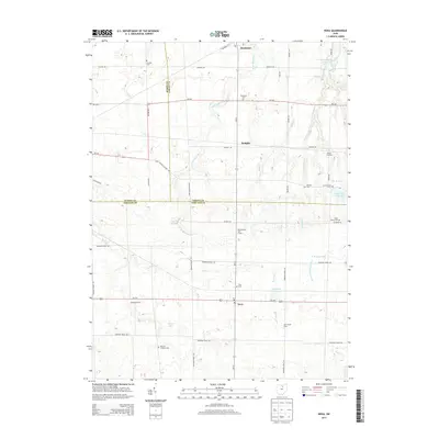
2013 Map of Nova
USGS Topo · Published 2013About this map
Nova serves as a central junction where Us-224 intersects with rural roads across the Ashland County line. This 2013 survey illustrates a landscape defined by its agricultural heritage and headwater drainage, where the W Br Black River and Buck Cr wind through a patchwork of family farms and small settlements like Semples and Bakers Crossing. The distribution of burial grounds, including the German Lutheran Cem, Beckley Cem, and Rochester Cem, provides a detailed record of 19th-century settlement patterns for the region. Notable local landmarks like Avon Maple Farm and Galloway Farms reflect the area's continued reliance on the land, while the northern village of Rochester marks a transition toward the Lorain County border. This map is particularly valuable for tracing lineage through its numerous rural cemeteries and identifying legacy farmsteads in the Ohio countryside.
Find a feature on this map
50 named features on this map. Tap any name to fly to it.
Don’t see what you’re looking for? This feature index may not catch every label — zoom into the map to look around manually.
Map Details
Editions of this 2013 Nova Map
This is the sole edition of this map. No revisions or reprints were ever made.
Other maps of this area

1904 · Wellington
USGS Topo · 1:62,500

1906 · Wellington
USGS Topo · 1:62,500

1906 · West Salem
USGS Topo · 1:62,500

1908 · Ashland
USGS Topo · 1:62,500

1908 · West Salem
USGS Topo · 1:62,500

1908 · New London
USGS Topo · 1:62,500

1950 · Marion
USGS Topo · 1:250,000

1956 · Toledo
USGS Topo · 1:250,000
1960 · Wellington
USGS Topo · 1:24,000

1960 · New London
USGS Topo · 1:24,000