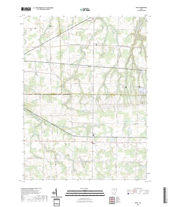
2023 Map of Nova
USGS Topo · Published 2023About this map
The northern reaches of Ashland County meet the borders of Huron and Lorain counties in this detailed topographic record. The village of Nova sits at the southern crossroads, accompanied by the nearby Nova Cem, while the northern settlement of Rochester marks the upper boundary. The landscape is defined by the branching waters of the West Branch Black River and East Creek, which carve through the agricultural terrain.
Find a feature on this map
36 named features on this map. Tap any name to fly to it.
Don’t see what you’re looking for? This feature index may not catch every label — zoom into the map to look around manually.
Map Details
Editions of this 2023 Nova Map
This is the sole edition of this map. No revisions or reprints were ever made.
Other maps of this area

1904 · Wellington
USGS Topo · 1:62,500

1906 · Wellington
USGS Topo · 1:62,500

1906 · West Salem
USGS Topo · 1:62,500

1908 · Ashland
USGS Topo · 1:62,500

1908 · West Salem
USGS Topo · 1:62,500

1908 · New London
USGS Topo · 1:62,500

1950 · Marion
USGS Topo · 1:250,000

1956 · Toledo
USGS Topo · 1:250,000
1960 · Wellington
USGS Topo · 1:24,000

1960 · New London
USGS Topo · 1:24,000