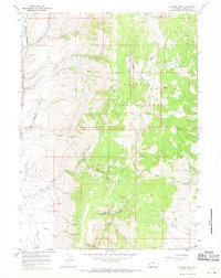
1967 Map of Nugent Park
USGS Topo · Published 1971About this map
The Bridger National Forest dominates this Wyoming landscape, where high-altitude ridges and deep canyons define the headwaters of the regional river systems. Centered on Nugent Park, the terrain is marked by sharp elevation changes between O K Ridge and several named drainages including Hams Fork and its West Fork. The map reveals a land utilized for its natural resources and livestock range, indicated by numerous water sources like Big Spring, Wyman Spring, and Pete Spring which are critical in this high-country environment.
Find a feature on this map
33 named features on this map. Tap any name to fly to it.
Don’t see what you’re looking for? This feature index may not catch every label — zoom into the map to look around manually.
Map Details
Editions of this 1967 Nugent Park Map
2 editions found
Other maps of this area

1936 · Cokeville
USGS Topo · 1:96,000

1942 · Cokeville
USGS Topo · 1:125,000

1955 · Preston
USGS Topo · 1:250,000

1958 · Preston
USGS Topo · 1:250,000

1962 · Preston
USGS Topo · 1:250,000
1967 · Pole Creek
USGS Topo · 1:24,000

1967 · Devils Hole Creek
USGS Topo · 1:24,000

1967 · Big Park
USGS Topo · 1:24,000
1967 · Wilkinson Creek
USGS Topo · 1:24,000

1967 · Huff Lake
USGS Topo · 1:24,000