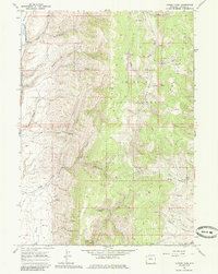
1967 Map of Nugent Park
USGS Topo · Published 1985About this map
Bridger National Forest encompasses the high mountain drainage systems of western Wyoming on this 1967 survey. The landscape is defined by the headwaters of the Smiths Fork and Hams Fork, where deep drainages like Sliderock Canyon and Buck Canyon carve through prominent landforms including Allen Ridge and Hams Fork Ridge. A network of trails and primitive roads connects isolated water sources such as Big Spring and various unnamed springs throughout the high country. The absence of permanent settlements suggests a landscape primarily utilized for seasonal grazing and timber management within the federal forest boundaries. Notable family or local place names like Mayfield Creek and Chappel Creek hint at the area's history of early homesteading or ranching in the high-altitude meadows of Nugent Park.
Find a feature on this map
35 named features on this map. Tap any name to fly to it.
Don’t see what you’re looking for? This feature index may not catch every label — zoom into the map to look around manually.
Map Details
Editions of this 1967 Nugent Park Map
2 editions found
Other maps of this area

1936 · Cokeville
USGS Topo · 1:96,000

1942 · Cokeville
USGS Topo · 1:125,000

1955 · Preston
USGS Topo · 1:250,000

1958 · Preston
USGS Topo · 1:250,000

1962 · Preston
USGS Topo · 1:250,000
1967 · Pole Creek
USGS Topo · 1:24,000

1967 · Devils Hole Creek
USGS Topo · 1:24,000

1967 · Big Park
USGS Topo · 1:24,000
1967 · Wilkinson Creek
USGS Topo · 1:24,000

1967 · Huff Lake
USGS Topo · 1:24,000