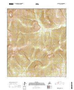
2017 Map of Nulato A-3 NW
USGS Topo · Published 2017About this map
Yuki River meanders through this interior Alaska landscape, defining a complex system of drainages within the Yukon-Koyukuk Census Area. The topography is dominated by significant elevation changes, with the river valley flanked by rising slopes that reach over 1,500 feet. In the southeastern portion of the quadrangle, the Little Mud River cuts across the township lines, while Minnesota Cr drains the western reaches. This 2017 survey by the U.S. Geological Survey illustrates the remote hydrography of the region, where natural watercourses provide the primary geographic markers across the vast sections of t14s r7e, t15s r8e, and surrounding townships. The lack of man-made infrastructure or named settlements highlights the wilderness character of this subarctic terrain.
Find a feature on this map
9 named features on this map. Tap any name to fly to it.
Don’t see what you’re looking for? This feature index may not catch every label — zoom into the map to look around manually.
Map Details
Editions of this 2017 Nulato A-3 NW Map
This is the sole edition of this map. No revisions or reprints were ever made.
Other maps of this area

1945 · Nulato
USGS Topo · 1:250,000

1951 · Nulato
USGS Topo · 1:250,000

1952 · Nulato A-4
USGS Topo · 1:63,360

1952 · Nulato B-3
USGS Topo · 1:63,360

1952 · Nulato B-4
USGS Topo · 1:63,360

1952 · Nulato A-3
USGS Topo · 1:63,360

1952 · Nulato
USGS Topo · 1:250,000
1953 · Nulato A-4
USGS Topo · 1:63,360

1964 · Nulato
USGS Topo · 1:250,000
2017 · Nulato A-3 SW
USGS Topo · 1:25,000