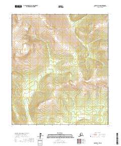
2017 Map of Nulato A-4 NE
USGS Topo · Published 2017About this map
Eddy Creek and California Creek flow through this section of the Yukon-Koyukuk region, revealing a landscape defined by sharp elevation changes and high ridges. The drainages of Colorado Creek and Minnesota Creek suggest a pattern of seasonal water flow typical of this subarctic environment. The lack of structures or developed roads in this 2017 survey emphasizes the area's isolation, where the primary organizational markers are the township and range boundaries of t14s r6e, t15s r6e, and t16s r6e. For those studying the hydrology of the Nulato A-4 NE quadrangle, the precise contour mapping illustrates how these various tributaries carve through the interior highlands, providing a detailed look at the drainage basins before they reach larger river systems.
Find a feature on this map
10 named features on this map. Tap any name to fly to it.
Don’t see what you’re looking for? This feature index may not catch every label — zoom into the map to look around manually.
Map Details
Editions of this 2017 Nulato A-4 NE Map
This is the sole edition of this map. No revisions or reprints were ever made.
Other maps of this area

1945 · Nulato
USGS Topo · 1:250,000

1951 · Nulato
USGS Topo · 1:250,000

1952 · Nulato A-4
USGS Topo · 1:63,360

1952 · Nulato B-3
USGS Topo · 1:63,360

1952 · Nulato B-4
USGS Topo · 1:63,360

1952 · Nulato A-3
USGS Topo · 1:63,360

1952 · Nulato
USGS Topo · 1:250,000
1953 · Nulato A-4
USGS Topo · 1:63,360

1964 · Nulato
USGS Topo · 1:250,000
2017 · Nulato A-3 SW
USGS Topo · 1:25,000