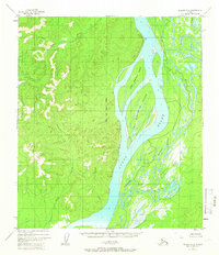
1952 Map of Nulato A-6
USGS Topo · Published 1966About this map
The Yukon River dominates this mid-century landscape as it flows past Big Eightmile Island and Little Eightmile Island. This section of the river valley is a complex network of waterways, where the Khotol River parallels the main channel through a maze of marshes and sloughs. On the western bank, the terrain rises sharply from Lears Point into the interior highlands, drained by the Rodo River and Poison Creek.
Find a feature on this map
10 named features on this map. Tap any name to fly to it.
Don’t see what you’re looking for? This feature index may not catch every label — zoom into the map to look around manually.
Map Details
Editions of this 1952 Nulato A-6 Map
2 editions found

Other maps of this area

1945 · Nulato
USGS Topo · 1:250,000

1948 · Norton Bay
USGS Topo · 1:250,000

1951 · Ophir
USGS Topo · 1:250,000

1951 · Nulato
USGS Topo · 1:250,000

1951 · Unalakleet
USGS Topo · 1:250,000

1951 · Norton Bay
USGS Topo · 1:250,000

1952 · Nulato A-5
USGS Topo · 1:63,360

1952 · Nulato B-6
USGS Topo · 1:63,360

1952 · Norton Bay B-1
USGS Topo · 1:63,360

1952 · Nulato B-5
USGS Topo · 1:63,360