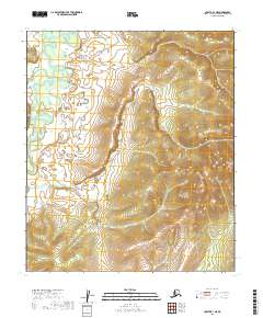
2019 Map of Nulato B-1 NE
USGS Topo · Published 2019About this map
Yuki River dominates the western portion of this landscape, meandering through a terrain defined by significant elevation changes. This 2019 survey by the U.S. Geological Survey illustrates the intersection of several public land survey divisions, including t11s r13e and t12s r14e. The area is characterized by a dense network of contour lines, reflecting the interior topography of the Yukon-Koyukuk Census Area. While the river corridor provides a low-lying baseline, the surrounding ridges and basins show a landscape largely untouched by industrial development or permanent settlements. The lack of man-made infrastructure on this modern sheet emphasizes the persistence of the natural hydrography and elevation patterns in this part of Alaska.
Find a feature on this map
7 named features on this map. Tap any name to fly to it.
Don’t see what you’re looking for? This feature index may not catch every label — zoom into the map to look around manually.
Map Details
Editions of this 2019 Nulato B-1 NE Map
This is the sole edition of this map. No revisions or reprints were ever made.
Other maps of this area

1945 · Nulato
USGS Topo · 1:250,000

1951 · Nulato
USGS Topo · 1:250,000

1951 · Ruby
USGS Topo · 1:250,000

1952 · Nulato C-1
USGS Topo · 1:63,360

1952 · Nulato B-1
USGS Topo · 1:63,360

1952 · Ruby B-6
USGS Topo · 1:63,360

1952 · Ruby C-6
USGS Topo · 1:63,360

1952 · Nulato
USGS Topo · 1:250,000

1952 · Ruby
USGS Topo · 1:250,000
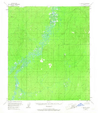
1953 · Nulato B-1
USGS Topo · 1:63,360