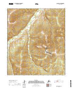
2019 Map of Nulato B-2 NW
USGS Topo · Published 2019About this map
Kalakaket Creek Air Station stands as the primary human landmark in this interior Alaskan landscape, positioned within the winding drainage of Kalakaket Cr. The terrain is characterized by a series of north-south ridges and deep valleys shaped by glacial and fluvial action. To the west, the smaller Kala Cr carves through the township boundaries of T12S R9E and T11S R9E. This 2019 survey reflects the isolation of the Yukon-Koyukuk region, where infrastructure is minimal and the environment is defined almost entirely by its complex hydrography. The map provides a clear record of the watershed's topographical contours and the specific placement of the air station, which serves as a critical point of access in a region without a developed road network.
Find a feature on this map
11 named features on this map. Tap any name to fly to it.
Don’t see what you’re looking for? This feature index may not catch every label — zoom into the map to look around manually.
Map Details
Editions of this 2019 Nulato B-2 NW Map
This is the sole edition of this map. No revisions or reprints were ever made.
Other maps of this area

1945 · Nulato
USGS Topo · 1:250,000

1951 · Nulato
USGS Topo · 1:250,000

1952 · Nulato B-2
USGS Topo · 1:63,360

1952 · Nulato C-3
USGS Topo · 1:63,360

1952 · Nulato C-2
USGS Topo · 1:63,360

1952 · Nulato B-3
USGS Topo · 1:63,360

1952 · Nulato
USGS Topo · 1:250,000
1953 · Nulato C-2
USGS Topo · 1:63,360

1964 · Nulato
USGS Topo · 1:250,000
2017 · Nulato B-3 SE
USGS Topo · 1:25,000