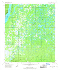
1953 Map of Nulato B-5
USGS Topo · Published 1967About this map
The Yukon River dominates the western edge of this 1953 landscape, weaving around Sevenmile Island and Halfway Island in a complex system of side channels and bars. The interior is a vast network of water and marsh, characterized by the winding Khotol River and a dense collection of interconnected waterways including Tlatskokat Slough and the ominously named Manslaughter Slough.
Find a feature on this map
27 named features on this map. Tap any name to fly to it.
Don’t see what you’re looking for? This feature index may not catch every label — zoom into the map to look around manually.
Map Details
Editions of this 1953 Nulato B-5 Map
2 editions found
Other maps of this area

1945 · Nulato
USGS Topo · 1:250,000

1951 · Nulato
USGS Topo · 1:250,000

1952 · Nulato A-5
USGS Topo · 1:63,360

1952 · Nulato B-6
USGS Topo · 1:63,360

1952 · Nulato C-4
USGS Topo · 1:63,360

1952 · Nulato A-4
USGS Topo · 1:63,360

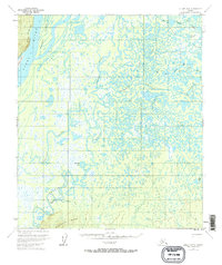
1952 · Nulato B-5
USGS Topo · 1:63,360

1952 · Nulato B-4
USGS Topo · 1:63,360

1952 · Nulato C-6
USGS Topo · 1:63,360

1952 · Nulato C-5
USGS Topo · 1:63,360