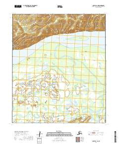
2019 Map of Nulato C-1 NE
USGS Topo · Published 2019About this map
The Yukon River dominates this interior landscape, carving a wide path through the Yukon-Koyukuk region. Along the northern bank, the sharp rise of Sandstone Bluff provides a distinct vertical contrast to the river's broad channel and the low-lying islands that split its flow. The presence of Yuki Island and Big Island indicates a dynamic fluvial environment where sediment deposition constantly reshapes the navigation channels.
Find a feature on this map
12 named features on this map. Tap any name to fly to it.
Don’t see what you’re looking for? This feature index may not catch every label — zoom into the map to look around manually.
Map Details
Editions of this 2019 Nulato C-1 NE Map
This is the sole edition of this map. No revisions or reprints were ever made.
Other maps of this area

1945 · Nulato
USGS Topo · 1:250,000

1951 · Nulato
USGS Topo · 1:250,000

1951 · Ruby
USGS Topo · 1:250,000

1952 · Nulato C-1
USGS Topo · 1:63,360

1952 · Nulato D-1
USGS Topo · 1:63,360

1952 · Ruby D-6
USGS Topo · 1:63,360

1952 · Ruby C-6
USGS Topo · 1:63,360

1952 · Nulato
USGS Topo · 1:250,000

1952 · Ruby
USGS Topo · 1:250,000

1964 · Ruby
USGS Topo · 1:250,000