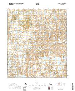
2017 Map of Nulato C-4 SE
USGS Topo · Published 2017About this map
Gorton Cr meanders through this interior Alaska landscape, defining a remote terrain of complex wetlands and subtle elevation shifts. The map illustrates a dense network of small lakes and seasonal ponds that dominate the lowland areas, typical of the Yukon-Koyukuk region. This 2017 survey reveals the intricate hydrography of a subarctic wilderness where the lack of roads and settlements underscores the natural isolation of the terrain. The Public Land Survey System grid, including t10s r6e and t11s r7e, provides the primary structural reference for this nearly untouched portion of the Alaskan interior, showing a landscape shaped by water and slow-moving drainage patterns.
Find a feature on this map
5 named features on this map. Tap any name to fly to it.
Don’t see what you’re looking for? This feature index may not catch every label — zoom into the map to look around manually.
Map Details
Editions of this 2017 Nulato C-4 SE Map
This is the sole edition of this map. No revisions or reprints were ever made.
Other maps of this area

1945 · Nulato
USGS Topo · 1:250,000

1951 · Nulato
USGS Topo · 1:250,000

1952 · Nulato C-3
USGS Topo · 1:63,360

1952 · Nulato C-4
USGS Topo · 1:63,360

1952 · Nulato B-3
USGS Topo · 1:63,360

1952 · Nulato B-4
USGS Topo · 1:63,360

1952 · Nulato
USGS Topo · 1:250,000
1953 · Nulato C-4
USGS Topo · 1:63,360

1964 · Nulato
USGS Topo · 1:250,000
2017 · Nulato C-4 NW
USGS Topo · 1:25,000