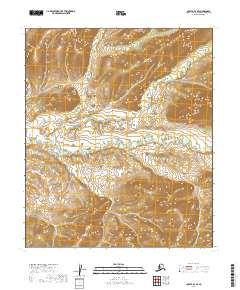
2019 Map of Nulato D-1 SE
USGS Topo · Published 2019About this map
Whakatna Cr meanders through this section of the Yukon-Koyukuk region, defining the central drainage pattern of a landscape dominated by significant topographic relief. The terrain is marked by distinct upland areas reaching elevations over 1,400 feet, which transition into the lower river valley. This 2019 survey documents the wild and undeveloped character of the Alaskan interior, where the natural hydrology and land divisions of the Public Land Survey System—including t7s r13e, t7s r14e, t8s r13e, and t8s r14e—provide the only markers of human organization in an otherwise untouched wilderness. The contour intervals reveal a complex series of ridges and basins that dictate the flow of the creek as it moves across the quadrangle.
Find a feature on this map
5 named features on this map. Tap any name to fly to it.
Don’t see what you’re looking for? This feature index may not catch every label — zoom into the map to look around manually.
Map Details
Editions of this 2019 Nulato D-1 SE Map
This is the sole edition of this map. No revisions or reprints were ever made.
Other maps of this area

1945 · Nulato
USGS Topo · 1:250,000

1951 · Nulato
USGS Topo · 1:250,000

1951 · Ruby
USGS Topo · 1:250,000

1952 · Nulato C-1
USGS Topo · 1:63,360

1952 · Nulato D-1
USGS Topo · 1:63,360

1952 · Ruby D-6
USGS Topo · 1:63,360

1952 · Ruby C-6
USGS Topo · 1:63,360

1952 · Nulato
USGS Topo · 1:250,000

1952 · Ruby
USGS Topo · 1:250,000

1964 · Ruby
USGS Topo · 1:250,000