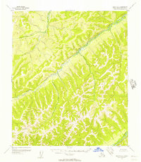
1955 Map of Nulato D-6
USGS Topo · Published 1957About this map
Gisasa River dominates the central interior of this mid-century topographic study, winding through the complex terrain of the Nulato (D-6) quadrangle. Surveyed through aerial photography in the early 1950s, the map reveals a remote landscape defined by the drainage patterns of the Nulato River in the southeast and the smaller Arvesta Creek in the north. The absence of roads or trails on this sheet highlights the wilderness character of the region during this era. The topography is meticulously documented with one-hundred-foot contours, illustrating the sharp ridgelines and narrow valleys that characterize the watershed divide. This survey was produced by the Geological Survey with control by the USCE, providing a primary record of the Alaskan interior before modern infrastructure arrived.
Find a feature on this map
3 named features on this map. Tap any name to fly to it.
Don’t see what you’re looking for? This feature index may not catch every label — zoom into the map to look around manually.
Map Details
Editions of this 1955 Nulato D-6 Map
2 editions found
Other maps of this area

1945 · Nulato
USGS Topo · 1:250,000

1948 · Norton Bay
USGS Topo · 1:250,000

1951 · Candle
USGS Topo · 1:250,000

1951 · Nulato
USGS Topo · 1:250,000

1951 · Norton Bay
USGS Topo · 1:250,000

1951 · Kateel River
USGS Topo · 1:250,000

1952 · Nulato D-5
USGS Topo · 1:63,360

1952 · Nulato C-6
USGS Topo · 1:63,360

1952 · Nulato C-5
USGS Topo · 1:63,360

1952 · Nulato
USGS Topo · 1:250,000